The human impulse to imagine a different social order has frequently relied on spatial and territorial distance. Throughout the history of Latin America, vast tracts of land have repeatedly been treated as tabula rasa—blank slates where an entirely new world could be designed, organized, and built from the ground up. Yet, these territories were never truly empty. From the colonial mythologies of El Dorado to the grand twentieth-century master plans of ambitious governments and multinational corporations, the act of drawing a new city has continually collided with the complex realities of the land and the people already inhabiting it.
For architects, urban planners, and visionaries, the point of departure has almost always been the architectural plan. Viewed from above, a sprawling territory can easily look like a clean sheet of paper, eagerly waiting for a central axis, a monumental square, or an orderly grid to impose geometric harmony. However, at eye level, that exact same ground is invariably full of life, topography, local culture, and the intricate, pre-existing paths that communities use to navigate their daily existence.
Long before the advent of modern urban planning, Latin America was already shaped by imagined territories born from external expectations. The enduring legend of El Dorado offers a prime historical example of this phenomenon. The story originated from the ancient Muisca rituals practiced at Lake Guatavita, located in present-day Colombia, where precious gold and emerald offerings were tossed into the deep waters as a tribute to the gods. Over time, Spanish chroniclers transformed these sacred indigenous practices into fantastic tales of a gilded ruler and extraordinary hidden wealth. Eventually, El Dorado ceased to describe a ritual or a person and instead became the geographical name of an elusive city of gold, imagined to exist somewhere deep within the uncharted map of the continent.
A specific place had become fundamentally defined by what outsiders desperately expected or desired to find there. Centuries later, during the twentieth century, this exact psychological urge to project ideal models onto untamed landscapes began to take physical, built form through modern architecture and state-sponsored urban planning.
Importing an American Model to the Amazon
One of the most striking twentieth-century experiments in imposing an external vision upon an unfamiliar territory was Fordlândia. Planned thousands of miles away from its actual physical site, the settlement was conceived in the late 1920s when industrialist Henry Ford set out to produce his own independent supply of rubber along the Tapajós River deep within the Brazilian Amazon. Ford intended to establish a thriving industrial town centered around a massive rubber plantation, entirely managed and operated under the social and cultural norms of Michigan.
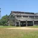
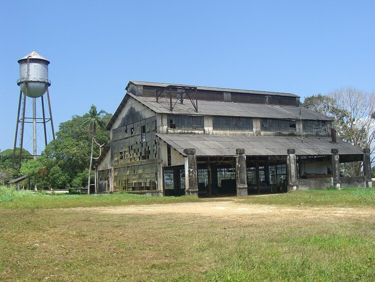
From his offices in the United States, Ford imagined a small American mill town miraculously recreated in the heart of the equatorial rainforest. Every detail was designed to reflect Midwestern industrial life, down to mandatory square dances, community baseball leagues, and a strict prohibition on alcohol consumption. The town’s layout took this utopian image quite literally. Rows of standardized workers’ bungalows were lined up neatly near the river dock, closely mimicking company towns in North America, while a towering steel water tower rose above the canopy, its loud whistle strictly marking the hours of labor.
The residential architecture itself was designed in Michigan and shipped directly to Brazil. In a fatal miscalculation of local climate and comfort, metal roofs were chosen over traditional, locally sourced thatch, trapping stifling heat under the relentless tropical sun. Daily routines followed the exact same imported template. Workers were expected to punch time clocks, adhere to rigid shift schedules, and consume American-style food in the company dining hall. Noted historian Greg Grandin, in his comprehensive book Fordlândia, described the ambitious project as a totalizing attempt to export an entire way of life into an ecosystem that fundamentally rejected it.
The imported model ultimately collapsed under the weight of ecological and social pressures. The rubber trees, planted in dense, unnatural rows rather than scattered naturally through the forest as they are in the wild, were quickly devastated by leaf blight and fungal disease. Furthermore, the cultural imposition proved unsustainable. In December 1930, a localized protest over food regulations in the company dining hall erupted into a full-scale riot, forcing terrified American managers to flee for their lives onto boats anchored in the river. Henry Ford had originally imagined a small town that could be successfully prefabricated and rebuilt anywhere on Earth; however, the complex realities of the Amazon rainforest and the agency of the local workers proved him entirely wrong.
Building a New Capital in Brazil’s Interior
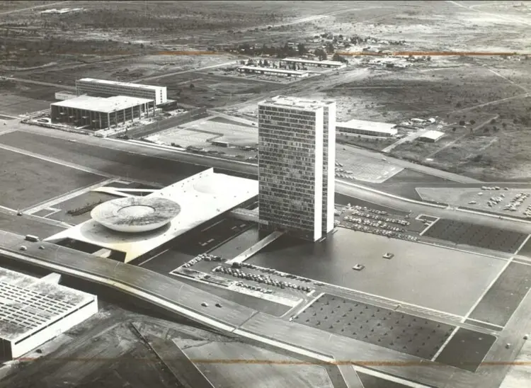
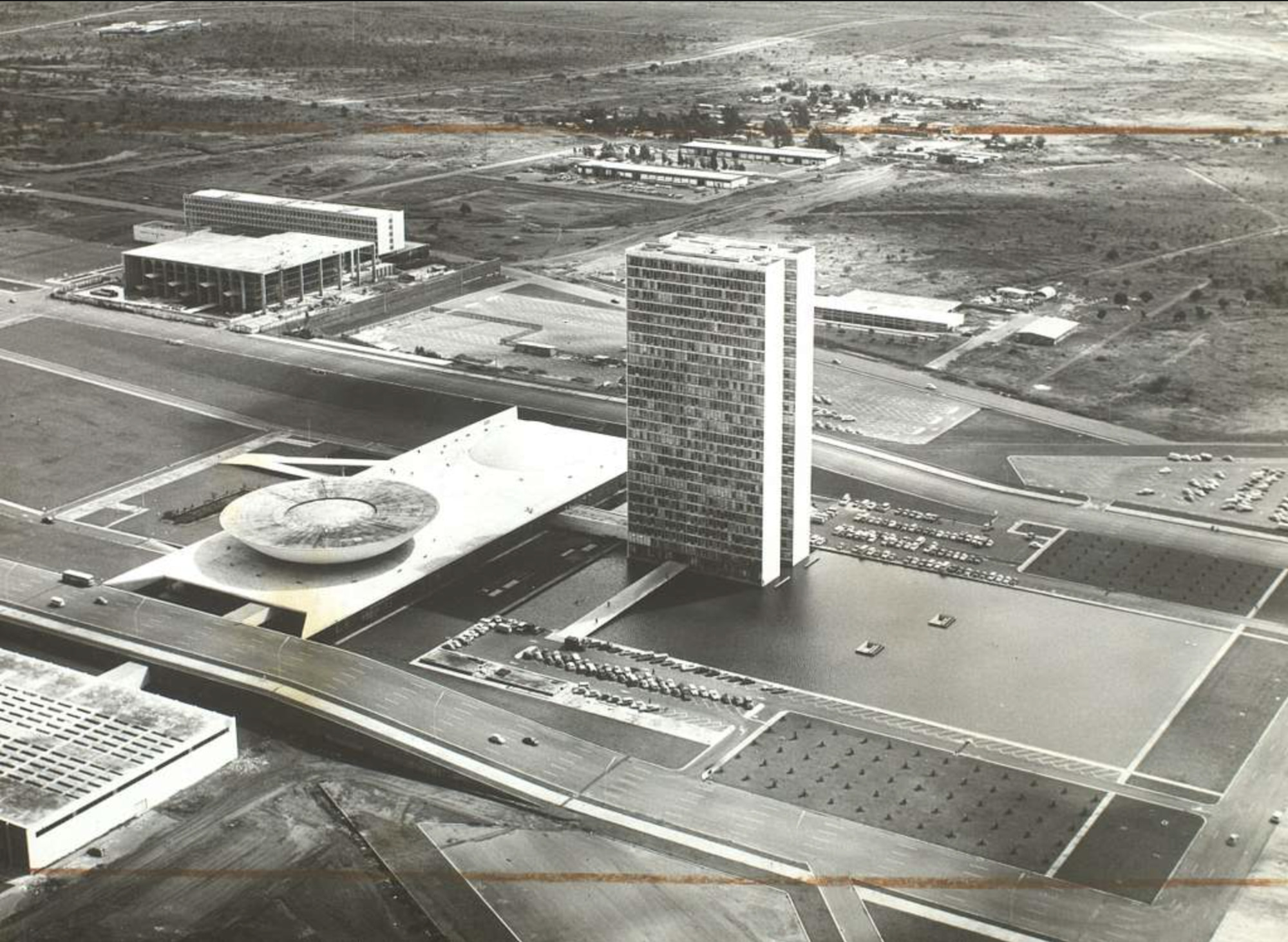
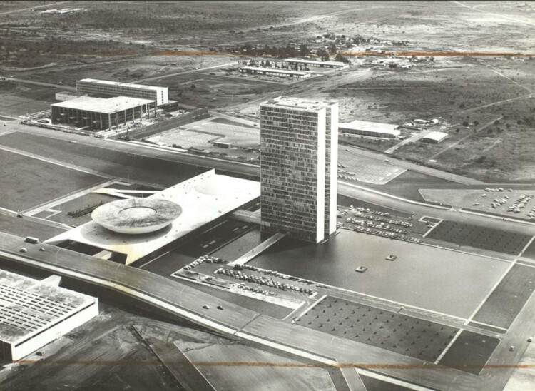
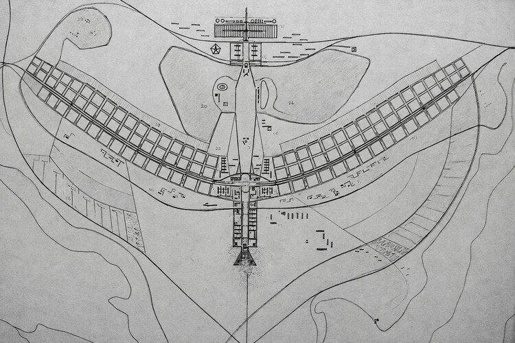
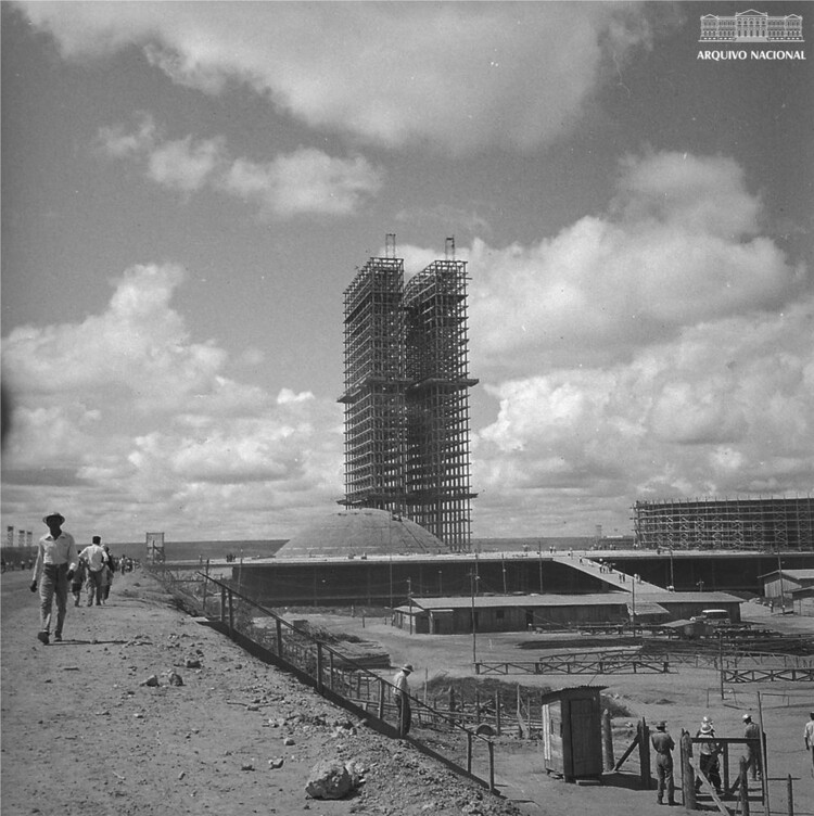
While Fordlândia attempted to transplant a Midwestern industrial village into the jungle, the creation of Brasília represented an indigenous national effort to reinvent an entire country from its geographic core. Conceived as a bold new federal capital for Brazil, the city was built inland as a cornerstone of President Juscelino Kubitschek’s sweeping national modernization project. The deliberate relocation of the capital from the coast was meant to signal a definitive break with the coastal enclaves that had governed the nation since the colonial era. Architect Lúcio Costa won the national competition for the city’s urban plan in 1957, and by 1960, a futuristic metropolis stood proudly on the high central plateau.
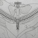
Costa’s master plan famously began with a single, foundational gesture. In his official competition report, he described the Plano Piloto as originating from the primal act of a pioneer marking a piece of land to claim it as their own, which he famously sketched as "two axes crossing at right angles, that is, the very sign of the cross." In doing so, Costa tied his hyper-modernist urban gesture directly back to centuries-old colonial traditions. Four centuries after the romanticized search for El Dorado, the founding of a sleek modern capital still borrowed the historic logic of territorial conquest and spatial subjugation.
Those two perpendicular axes organized virtually every aspect of the new city. The curved Residential Axis contained the famous superquadras—modular housing blocks elevated delicately on pilotis and surrounded by generous shared green spaces designed to foster egalitarian community life. Meanwhile, the grand Monumental Axis concentrated the nation’s primary government ministries, civic buildings, and monuments, featuring some of Oscar Niemeyer’s most iconic and expressive architectural masterworks. The final result was a city defined by vast distances, monumental scale, and sweeping open grounds, laid out as if the high plateau had been an untouched, empty canvas.
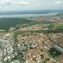
Constructing this utopian capital, however, required the grueling physical labor of tens of thousands of migrant workers, known historically as candangos, many of whom hailed from Brazil’s impoverished Northeast. During the construction boom, these workers lived in temporary camps and informal settlements such as Cidade Livre, a community explicitly intended to vanish once the capital was fully completed.
In practice, very few of these builders found a permanent place within the pristine core of the city they had erected. While the superquadras became exclusive enclaves for the political and bureaucratic elite, working-class residents were systematically relocated to distant satellite towns. Settlements like Taguatinga were created for residents removed from early informal camps, and later Ceilândia was founded in 1971 to absorb further housing displacement. Today, the strictly protected Plano Piloto sits at the wealthy center of a sprawling metropolitan region, housing less than a tenth of the total population of the Federal District.
Planning a New Industrial City in Venezuela
In the early 1960s, the drive to engineer new urban centers manifested in southeastern Venezuela with the creation of Ciudad Guayana. Designed to harness the region’s immense iron ore deposits and hydroelectric potential where the Orinoco and Caroní rivers converge, the city was a joint enterprise between the Corporación Venezolana de Guayana and the Joint Center for Urban Studies of MIT and Harvard. For the international and local planners involved, the project presented a rare, highly coveted opportunity: the chance to design an entire industrial city from scratch.
The master plan organized Ciudad Guayana as a linear city, with Avenida Guayana serving as its central economic and structural spine, connecting heavy industrial sectors directly to commercial districts and residential neighborhoods. Urban researchers have frequently analyzed the project as a massive urban laboratory where cutting-edge planning theories could be tested at an unprecedented regional scale.
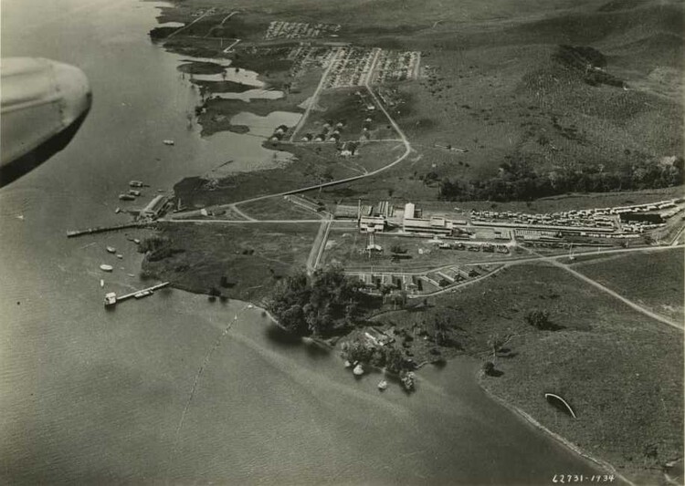
Nevertheless, the designated site was far from uninhabited. On the west bank of the Caroní River stood Puerto Ordaz, a structured company town built for an American iron mining enterprise and designed by Josep Lluís Sert, one of the foremost figures of the Modern Movement (CIAM). On the east bank lay San Félix, a historic fishing village where the vast majority of new job-seekers and working-class migrants chose to settle. By 1962, approximately 20,000 people were already living in self-built, informal settlements across a city that was still actively being drawn on drafting tables.
Discrepancies quickly emerged between the official master plan and lived reality. While planners intentionally positioned new housing developments near the western industrial zones, most working-class residents continued to build their lives around San Félix. Furthermore, while the planners envisioned socially integrated, mixed-income neighborhoods, Puerto Ordaz naturally gravitated toward becoming an enclave for middle- and upper-income managerial staff.
This fundamental divide was clearly documented by urban designer Donald Appleyard, a member of the MIT-Harvard research team. Appleyard asked local residents to sketch their own mental maps of Ciudad Guayana and compared them directly against the official drawings produced by the planners. The master plan conceptualized the city as a closed, rational system, whereas the residents mapped the specific routes, social hubs, and informal pathways that they actually relied upon. Their alternative maps revealed rich layers of urban life that remained entirely invisible within the rigid framework of the official blueprint.
What Happens Beyond the Plan
Fordlândia, Brasília, and Ciudad Guayana emerged from vastly different historical moments, economic imperatives, and political ideologies. Yet, each project was driven by the exact same foundational hope: the belief that removing oneself to an alternative territory would make it entirely possible to organize human society from scratch. The architectural and urban plan made that ambitious hope feel tangibly achievable. Seen safely from above, a vast, complex, and socially rich territory could be neatly drawn, categorized, and reorganized as if nothing of value already existed there.
What invariably transpired after construction concluded, however, was far less controlled. Fordlândia collided harshly with an ecosystem and a local culture that rejected imported industrial regimentation. Brasília expanded dramatically beyond the strict ideological boundaries of the Plano Piloto, giving rise to a complex metropolitan reality. Ciudad Guayana evolved through dynamic neighborhoods, commercial networks, and daily pedestrian routes that the master planners’ idealized vision failed to anticipate or accommodate.
Ultimately, the persistent lure of beginning anew elsewhere depends heavily on how a territory is interpreted and understood before construction ever begins. That initial reading is rarely, if ever, shared by the people who already call the land home. As these historical experiments demonstrate, the fundamental question remains: who ultimately gets to decide what a place is, and what vital aspects of human existence are left outside of that bureaucratic decision?