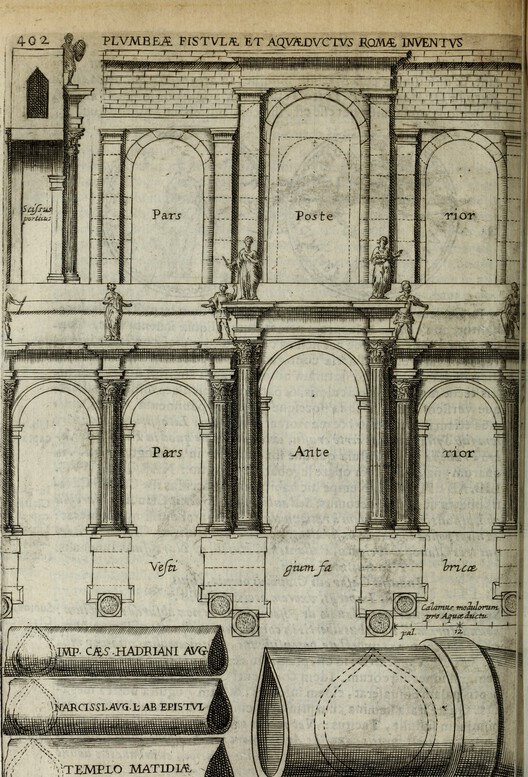
When the Ostrogoths besieged Rome in 537 AD, their very first military act was as symbolic as it was strategic: they cut the city’s aqueducts. At the time, eleven gravity-fed channels supplied Rome with up to one million cubic meters of water per day—a staggering volume that was more than enough to sustain a booming population of over a million people, supply the monumental public baths, and scour the extensive subterranean sewer networks. Without those aqueducts, Rome was rapidly reduced to a fortified enclosure huddled around a contaminated, unusable river. The siege brutally underscored a fundamental truth that has defined human civilization ever since: water is not merely a resource, but the absolute prerequisite for a city’s existence.
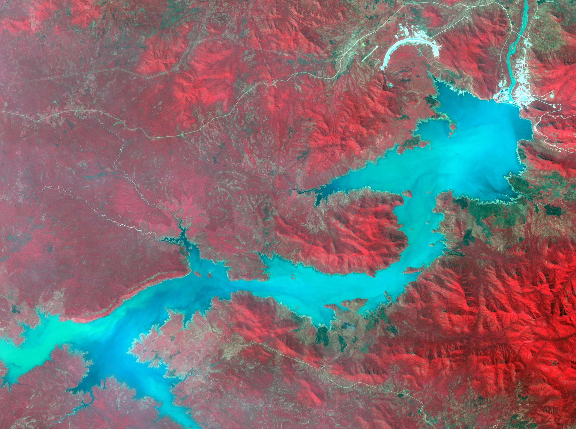
Unlike land, which can be neatly fenced off and titled, or oil, which can be safely stored in barrels and tanks, water is a radically fluid, evasive resource that defies absolute ownership while remaining utterly dependent on everyone. It seeps through subterranean aquifers, crosses rigid international borders, and rushes down winding river systems. The ancient Romans were acutely cognizant of this geopolitical and physical reality. Because the aqueducts constituted vital public infrastructure, the water flowing freely into the city’s civic fountains was accessible to all citizens regardless of social standing. Frontinus, the diligent Roman administrator who oversaw the city’s complex water system in the first century AD, documented every official allocation, every illegal private connection, and every abuse of the system with the meticulous rigor of someone who understood that water management was fundamentally a civic and political act. In this sense, architecture has always possessed the profound capacity to render water a shared common good—or, by altering its channels, to turn it into an exclusive privilege.
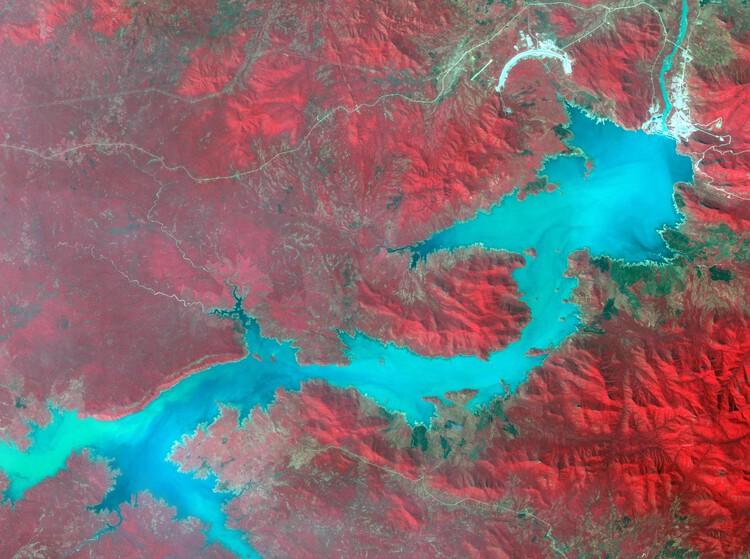
Upstream and downstream are positions in a watershed that determine, with the unyielding precision of topography, who absorbs the immediate and long-term consequences of human decisions. Architecture has always known how to work with gravity; what it has been historically slower to acknowledge is that gravity is, by its very nature, deeply political.
The Dam
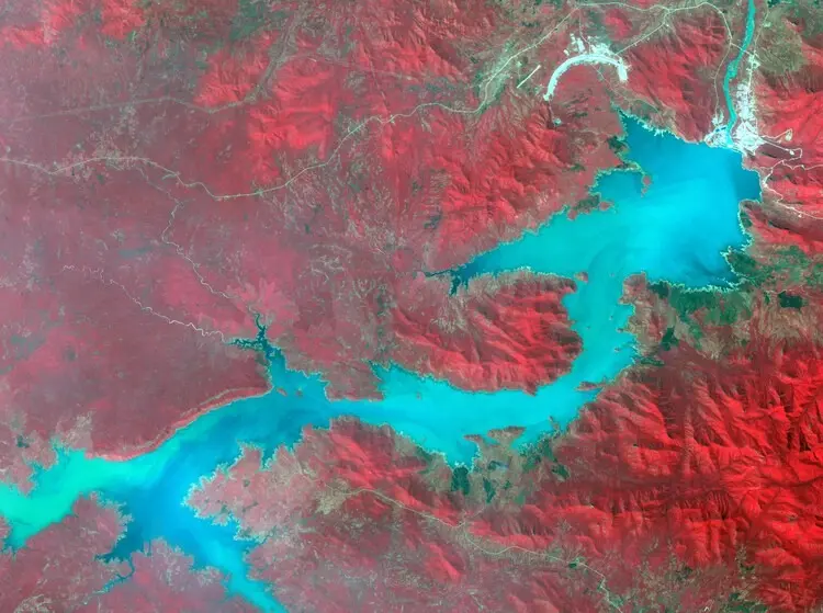
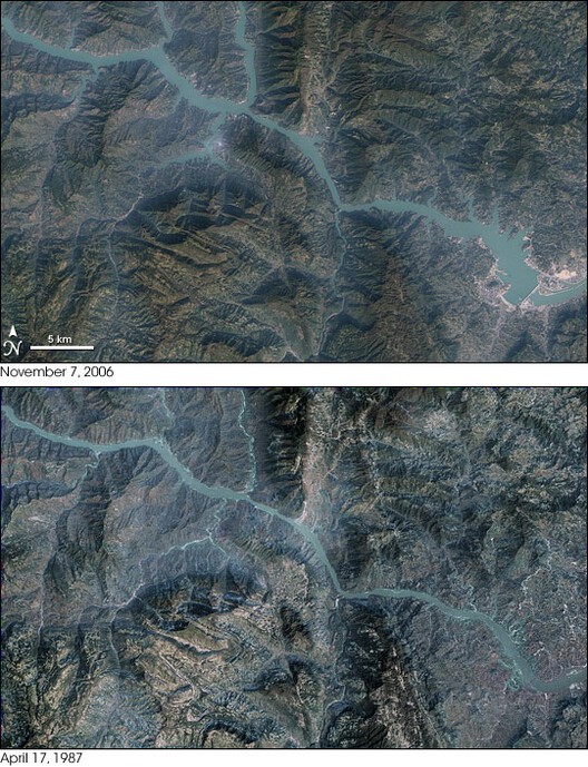
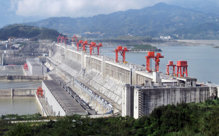
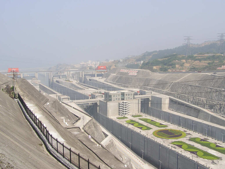
In 1997, Jiang Zemin, the fourth paramount leader of China, presided over the official ceremony marking the monumental diversion of the Yangtze River. Jiang is widely reported to have declared that "man must conquer nature," a bold motto that soon came to epitomize the spirit and ambition of the entire project. The colossal main wall of the project was ultimately completed in 2006, stretching an astonishing 2.3 kilometers long and rising about 181 meters tall, while the massive reservoir took years to gradually fill. By the time the water reached its final, projected height in 2010, the impoundment had completely submerged 13 major cities, 140 towns, and 1,350 villages, alongside more than 1,300 known historical and archaeological sites.
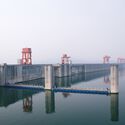
The Three Gorges Dam stands as the largest hydroelectric project ever constructed by human hands, but it also holds the dubious distinction of being the largest displacement project in modern history. The dam generates an immense volume of hydroelectricity, successfully supplying a significant portion of China’s rapidly developing eastern seaboard with reliable power. Yet, this achievement came at an astronomical human cost. Approximately 1.3 million people were forcibly or reluctantly resettled along the jagged edges of the newly formed reservoir. These included farming communities scattered across Chongqing and Hubei whose ancestral agricultural land simply disappeared underwater. Their replacement plots, awkwardly allocated on the steep, unstable hillsides high above the waterline, proved largely uncultivated and heavily eroded, while their promised financial compensation was frequently absorbed or delayed by administrative friction. While the project successfully protected an estimated 15 million people living downstream from catastrophic, life-threatening seasonal flooding, it simultaneously displaced more than a million people upstream.
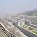
This reveals the true architecture of the dam—not merely the engineering marvel of its concrete face or the roaring spectacle of its massive spillways, but the sweeping territorial logic it relentlessly enacts. Every single hydrological impoundment creates a stark geography of beneficiaries on one side and a geography of profound renunciation on the other. The dam does not distribute its sweeping consequences according to human need or moral merit; instead, it distributes them strictly according to position in the physical landscape, which is to say, according to existing structures of power. Architecture is never merely an aesthetic vessel or neutral shelter; it is an active apparatus that organizes, sorts, and hierarchizes human bodies in space. The modern dam remains among the most explicit manifestations of that spatial hierarchy.
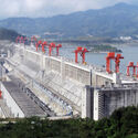
The broader history of modern architecture is thoroughly saturated with an uncritical admiration for large-scale hydraulic infrastructure—celebrating the precision of its engineering, the sheer scale of its ambition, and the imposing image of human civilization subduing natural systems. Yet, what is consistently omitted from these heroic narratives is the other side of the reservoir: the disappearing towns, the fertile and lost arable land, and the fragmented, displaced communities. Architecture, like any specialized discipline, produces its objects and theories through the specific questions it chooses to ask. When it asks how a dam stands against pressure, how its spillways perform during peak flows, or how its colossal mass meets the natural landscape, it is simultaneously choosing not to ask what the landscape was before the flood, and whose lives were uprooted to make it possible. While hydrology has advanced mathematical models for sediment displacement, ecology possesses rigorous frameworks for tracking habitat loss, and displacement studies utilize methodologies for monitoring resettled populations, architecture—which claims the organization of space as its core competence—has largely known what it erases without learning how to genuinely work with what remains.
The Aswan High Dam, completed in Egypt in 1970, similarly displaced an estimated 100,000 Indigenous Nubians from their ancestral territory along the banks of the Nile River. This displacement was widely described as epistemic, effectively erasing a distinct culture that had already survived a previous, painful displacement caused by the construction of the Aswan Low Dam by British colonialists back in 1902. The High Dam was hailed across Egypt as the ultimate symbol of postcolonial modernity, industrialization, and national pride; the Nubians who watched their ancient villages vanish beneath the reservoir were, in a very real sense, treated as the acceptable collateral cost of someone else’s progress.
The Grand Ethiopian Renaissance Dam (GERD) on the Blue Nile reopens this contentious history from the opposing side of the watershed. When Ethiopia formally broke ground on construction in 2011, it shattered a rigid water allocation framework that had stood unchallenged since the colonial era. This included a restrictive 1929 treaty—later renegotiated in 1959—which had guaranteed Egypt an immense annual supply of 55.5 billion cubic meters of Nile water while granting Cairo effective, unilateral veto power over any upstream infrastructure development across the basin. That foundational treaty was signed without Ethiopia’s participation, allocating the entirety of a shared river between Egypt and Sudan, even though its largest and most vital tributary—the Blue Nile, which contributes roughly 85 percent of the Nile’s total natural flow—originates entirely within the Ethiopian highlands. Despite supplying the vast majority of the water, Ethiopia was legally entitled to use less than one percent of it. The colonial legal framework had successfully built an invisible structural architecture that controlled the river’s benefits just as surely as any physical concrete wall.
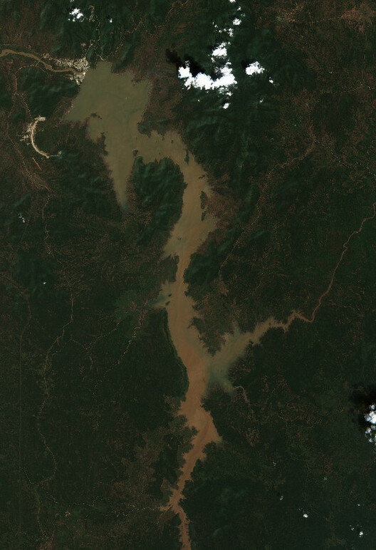
The GERD, which has now grown to become the largest dam in Africa, represents Ethiopia’s definitive geopolitical assertion that this lopsided arrangement was nothing more than an outdated colonial artifact. Egypt, conversely, maintains that the massive dam constitutes an existential threat to its national water security, pointing out that an astonishing 98 percent of its renewable water resources originate from the Nile. Without a guaranteed minimum annual flow, Egypt’s agricultural sector and national electricity generation face the terrifying prospect of total collapse. Here stand two entirely irreconcilable claims over the exact same river, both grounded in genuine, urgent national need. Unlike the rural communities displaced by the Three Gorges, who were at least nominally subjects of the very state that displaced them and theoretically eligible for administrative compensation, Egypt possesses no international legal mechanism to compel a sovereign upstream neighbor.
Day Zero
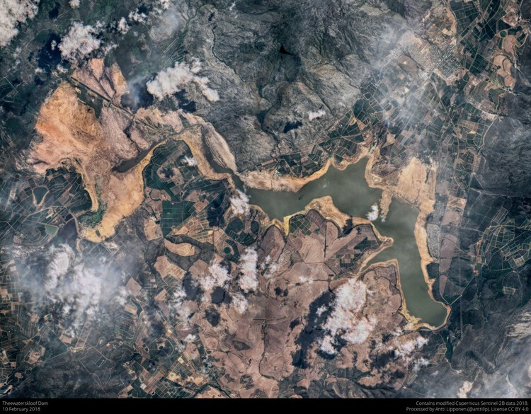
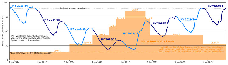
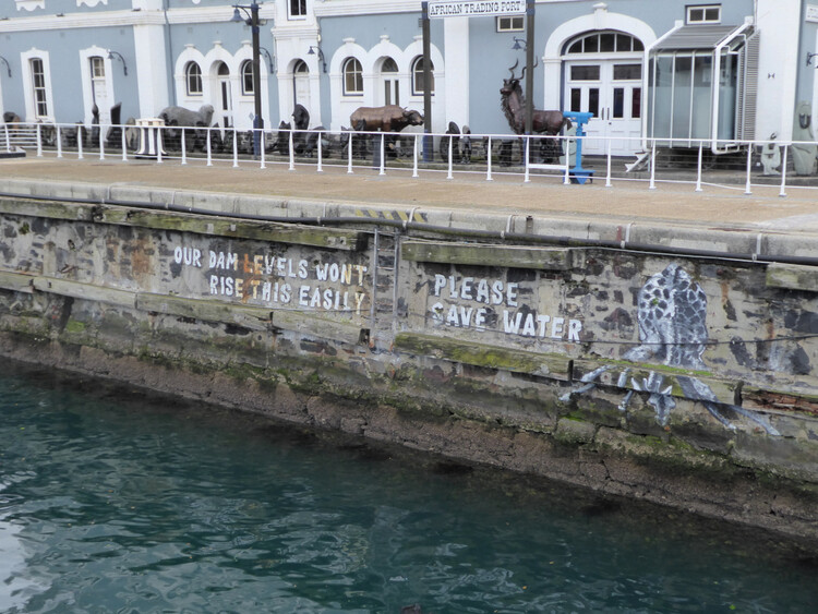
In January 2018, the South African city of Cape Town sent shockwaves around the world when it announced that it was rapidly approaching a terrifying threshold: local dam levels were plummeting below 13.5 percent of total capacity, meaning the municipality would soon be forced to completely shut off running water taps to the vast majority of the city’s 3.7 million residents. The widely publicized "Day Zero" announcement quickly dominated international headlines as stark, tangible evidence of a terrifying new category of urban catastrophe—a major, modern metropolitan center on the absolute verge of running entirely dry. Fortunately, by July of that same year, strong and timely winter rains finally pushed regional dam levels back above 50 percent capacity, allowing authorities to officially declare the immediate crisis over.
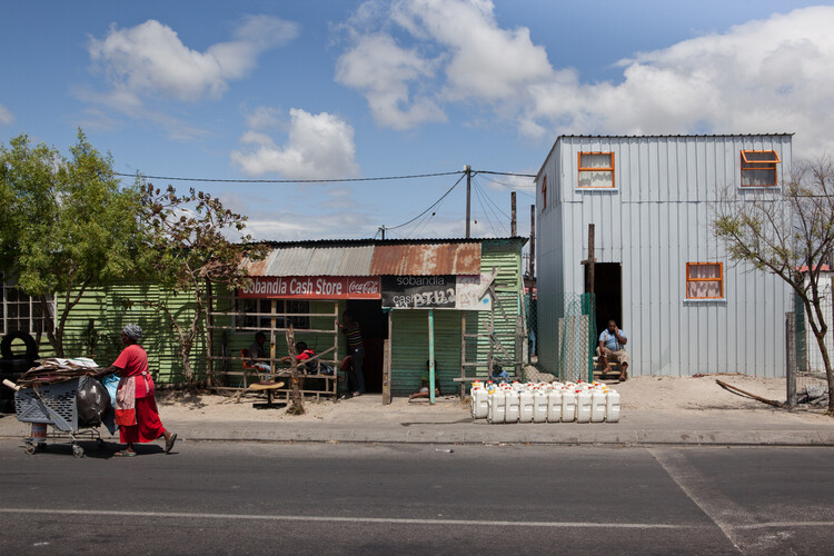
Across many rapidly expanding cities throughout the Global South, municipal water infrastructure was originally designed for populations that were significantly smaller, less dense, and distributed according to restrictive colonial planning logics. These systems were deliberately engineered to reserve reliable, high-pressure formal services for select, privileged neighborhoods while systematically withholding them from marginalized areas. When these cities experienced massive, informal growth, they absorbed millions of new residents into sprawling settlements that accumulated rapidly on the urban periphery. The formal municipal infrastructure failed to expand or adapt to meet this new reality. Lacking adequate water pressure, metered connections, and the vital system redundancies that ensure urban resilience, vulnerable areas suffered profoundly. By 2018, the informal settlements of Khayelitsha and Mitchell’s Plain were receiving meager water allocations through communal standpipes, delivering less than 25 liters per person per day—ironically matching the strict emergency rationing limit that the city was proposing for its affluent, formal residential areas under the "Day Zero" guidelines.
During the dark decades of apartheid, water and sanitation services in South Africa were sharply fractured across 25 separate municipal entities, each designated to serve a strictly segregated racial population. Non-white townships received only what meager resources remained after white residential areas had been fully supplied, and the pipes and pumps that reached those marginalized communities were frequently neglected or poorly maintained by design. When the apartheid regime officially collapsed in 1994, this deeply unequal physical infrastructure did not simply vanish. By the time the drought hit in 2018, formal, privileged households consumed 66 percent of the city’s total water supply, while the sprawling informal settlements—home to roughly 14 percent of Cape Town’s total households—relied on a mere 4 percent. Consequently, the emergency water restrictions introduced during the drought fell with crushing, indiscriminate weight on a household already struggling to survive on 30 liters a day just as they did on a suburban home consuming 300.
Noted anthropologist Nikhil Anand, drawing from his extensive field research studying Mumbai’s fragile water infrastructure, coined the term "hydraulic citizenship" to describe this condition. It refers to the precarious capacity of urban residents to be formally recognized by city agencies and governments solely through legitimate, recognized water connections. Those who remain unconnected are not merely underserved in a technical sense; within the cold administrative logic of the modern municipality, they are treated as though they are not yet fully urban. Similarly, geographer Erik Swyngedouw, whose research spans across Guayaquil and other major cities of the Global South, argues persuasively that water never flows purely according to natural biological need. Instead, it flows exclusively through deeply entrenched networks of power, political technology, and cultural meaning, making systemic scarcity a profoundly socially produced condition. In Guayaquil, where 600,000 residents lacked basic access to potable water despite the city sitting atop abundant natural resources, impoverished neighborhoods were forced to rely entirely on predatory private tanker trucks charging exorbitant prices that consumed a staggering share of household income. The bitter struggle for water in cities like Guayaquil and Cape Town is, as Swyngedouw argues, fundamentally a struggle not just for a basic physical right to water, but for the fundamental right to the city itself.
The Border
Political theorist Stuart Elden has argued convincingly that human civilization has long conceptualized territory through the wrong dimension—treating it primarily as a flat surface to be neatly divided by lines on a map rather than as a complex, three-dimensional volume that extends vertically both high into the atmosphere and deep down into the subsoil and the dark depths of the marine environment. China is currently executing this three-dimensional territorial strategy in the South China Sea, where Beijing is not merely claiming a traditional line drawn on a map, but is actively constructing an entirely new physical volume. By dredging massive amounts of sand and coral material directly from the seabed, raising it high above the natural water surface, and subsequently asserting that the entire column of airspace above it and the surrounding water now falls under a different political jurisdiction, it is rewriting the rules of space. The foundational United Nations Convention on the Law of the Sea (UNCLOS) was originally drafted for a world of flat surfaces, whereas the modern artificial island operates entirely within depth. Contemporary territorial law, including the legal architecture governing international waters, was built on the comforting assumption of surfaces, leaving a dangerous void regarding political control over what lies simultaneously above and below.
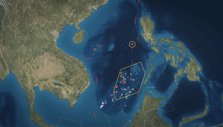
Between December 2013 and October 2015, China engaged in massive dredging operations, scooping up sand and marine debris from the seabed of the contested Spratly Islands and depositing it systematically onto seven submerged coral reefs, successfully manufacturing close to 3,000 acres of entirely new land. What China constructed was not simply a surface territorial marker, but a robust volume of sovereign infrastructure. By forcibly extracting material from the ocean floor, lifting it above the waterline, and establishing physical facilities, Beijing asserted that the surrounding column of water and sky was now subject to its authority. While international legal frameworks like UNCLOS explicitly state that artificial islands do not generate any territorial sea of their own—a legal reality upheld by a 2016 arbitral tribunal ruling brought by the Philippines, which declared China’s expansive "nine-dash line" maritime claims legally baseless—the geopolitical reality on the ground operates on a different logic. The consistent strategy relies on building physical infrastructure first and disputing the legality later, betting heavily on the fact that there is no international enforcement mechanism capable of physically removing what has already been constructed of concrete and sand.
Across every diverse case examined here—from ancient Roman aqueducts and towering hydroelectric dams to drought-stricken municipal networks and contested marine reefs—water has been meticulously directed, physically contained, strictly rationed, and manufactured into tangible territory through the agency of architecture and engineering. The physical interventions of architecture possess a permanence and an irreversibility that abstract legal arguments simply cannot match, and that enduring reality remains the central truth of our watery world.